

STOCKLINCH
There are many lovely walks around Stocklinch and here you can find details about some of them. If you know of a walk that you would like to recommend please contact us with details and we will put it up on this page.
It is wonderful to have the 'Rights of Way' but, it also means that you have to show respect and not disturb the land, wild animals, livestock and other peoples property.
Any person using a public footpath has the right to remove as much of any obstruction as necessary to allow him or her to pass, but not to cause wilful damage to property. If the obstruction cannot be removed the walker is entitled to leave the path and walk around it, causing no more damage than necessary. If the path has been sown with crops you are entitled to follow the route even if it means treading on the crop. But remember to walk in a single file to make as little damage as possible.
To print out a copy of the map of the footpaths around Stocklinch, please click below
To view a specific walk, click on the link below each walk.
Walk 1 -
Start: corner Tunway / Stoney Lane
Proceed up Stoney Lane, at the top turn left. Proceed along level and down to intersection and turn left on signed road and back to start.
Walk 2 -
Start: corner Tunway / Stoney Lane
Proceed out of village on Tunway and when pumping station is reached turn left on to track, over stream and straight ahead over field. On reaching farm track turn left passing Selvinge farm. Straight along track crossing road (Stocklinch -
Look for gate on left before farm buildings, cross field, cross stream and proceed across fields (blue rubber tubing on electric fence).
Proceed to stile on road opposite entrance to Stocklinch Manor. Turn left and return to start through village.
Walk 3 -
Start: Lower church (Mary Magdalen) in the village
Proceed to entrance to Stocklinch Manor and take footpath over stile opposite. Proceed across stream and on reaching road turn right and almost immediately cross road and follow path towards Whitelackington.
Proceed across stream and across field towards bypass. If this is not possible, go around edges of field to meet farm track and steps up to road to cross bypass.
Take right hand fork at Whitelackington and go up to old A303. Immediately turn right and in to drive of Dillington House.
Follow drive passing house on left. On reaching road at Ashwell turn right and over bypass and down steps to track bears right and into wood keep river Isle on right. On reaching old building proceed ahead towards marker in field. Bear slightly left and aim for river bank at The Bridges farm. On reaching road turn right and follow signposted road back to Stocklinch. Be very careful on this stretch as there is much traffic.
Walk 4 -
Start: Stocklinch Manor Entrance
Take footpath opposite Stocklinch Manor Entrance and proceed over fields and footbridge to road at Atherstone.
On reaching road turn right and almost immediately take signed path on opposite side of road. Cross field and stream and make for top corner of field near bypass.
Take farm track and up steps to cross road and bypass. Take right fork at Whitelackington. On reaching the old A303 turn right and cross road and look for signed path going into wood.
Pass ponds on right and on coming into fields look for church tower of Kingstone church.
Pass church on right and immediately turn right towards houses. Path is on right and may be difficult to see. It curves slightly to left and joins road at corner of Kingston Hill.
Proceed down hill and take signed path to right at Knott Oak. Cross fields and rejoin path taken on outward journey. Turn left on meeting this path and with ponds on left return on this path in reverse direction.
Walk 5 -
Start: Corner of Tunway/Stoney Lane
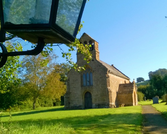
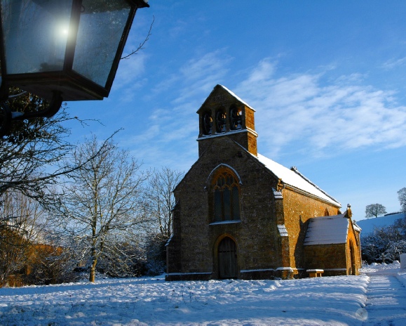
This walk takes you to both of the churches in Stocklinch, St Mary Magdalen and St Mary Ottersey, and it is a lovely way of seeing the village.
Walk up Stoney Lane, pass some of the medieval houses in the village. Before the lane starts climbing steeply uphill and just after the last house on your right, turn right, following a track up alongside the house.
At the top, continue through the kissing gate and cross the filed to the other side. There are some lovely views from the top of this field, across the valley of the river Isle towards the Quantock and Blackdown Hills. At the bottom of the field, to your right, you can see St Mary Magdalen with its characteristic bell tower.
When you crossed the field you come to another kissing gate, walk over the ditch and through the little gate. Go straight on. To your right, behind the trees lies Stocklinch Manor and a head of you, behind the group of trees you can see the church tower of St Mary Ottersey.
It is well worth having a look inside the church. Even though the font suggests that there was a church on this site in the Norman times, the earliest known documentary references are from 1321.
Leaving the church, and with the church behind you, walk down the field to the big farm gate. There is a kissing gate to the left. Go through the gate and you will come out on a lane with some houses oppose. Turn right and you walk pass Stocklinch Manor on your right hand. When you come to the T junction turn right and walk down Owl Lane. You will soon come to St Mary Magdalen church on your right. The church was built in the early part of the 14th century. If you carry on walking down Owl Lane it will take you pass the Village Hall on your left to the corner of Tunway and Stoney Lane where you started.
Walk 6 -
Start: Corner of Tunway/Stoney Lane
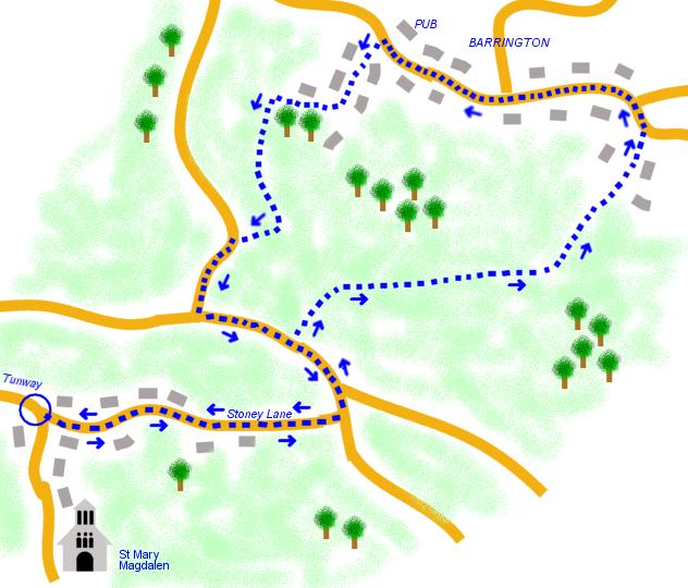
Walk up Stoney Lane and turn left at the top of the hill. Carry on and shortly you will come to a widening of the lane and you will find a foot path up on your right hand side. Climb over the stile and walk across the field and over the stile on the other side.
Turn left and follow the foot path along side the field. Carry on walking until you come to the end of the field and you have two stiles in front of you, one to you right and one a little bit further on to your left.
Climb the left stile* and walk down across the field. You can see a stile just at the bottom by the houses. Go over the style and the path takes you through some houses down to Barrington high street, where you turn left.
*Alternatively: instead of climbing over the stile and down across the field, there is a path going down on the left of the field which also takes you down the Barrington high street, where you turn left.
Walk through the village and you will see some lovely old Hamstone houses. You will pass the Old Oak Inn on your right and the church on your left. Shortly after the church, just before the red telephone box, take Copse Shute Lane/Lobbs Lane to the left. Following up the lane through some houses and when you come to Copse Shute House there is a green 'Public Footpath' sign pointing to the right. Follow the narrow lane just up by the thatched cottage.
Climb over the stile at the top and follow the footpath up to the top of the field where there is another stile to climb. Here you have a lovely view and on a clear day you can even see Glastonbury Tor.
Turn left and follow the footpath alongside the fields. Turn right when you come to a down hill bit of the path where you can either choose a path to the left across a stile or turn right. Carry on walking alongside the field. You will come to a country lane with a football pitch oppose. Turn left here and keep on walking until you come to a T junction. Turn left here and you will join the lane you walked before you climbed the first stile.

WALKS
| Corona Virus |